It starts with the client’s question. We then develop a suitable route concept. From idea to actual end product. This includes the design and realisation of a walking or cycling network and monitoring of cycling and walking routes. Continue reading
Monthly Archives: July 2023
Monitoring
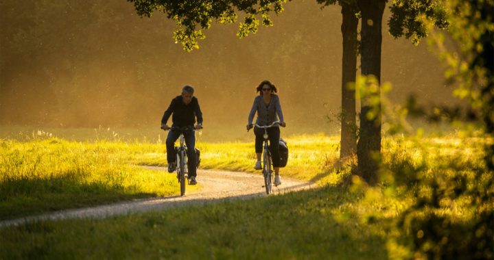
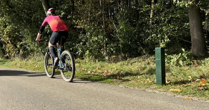
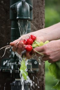
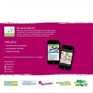
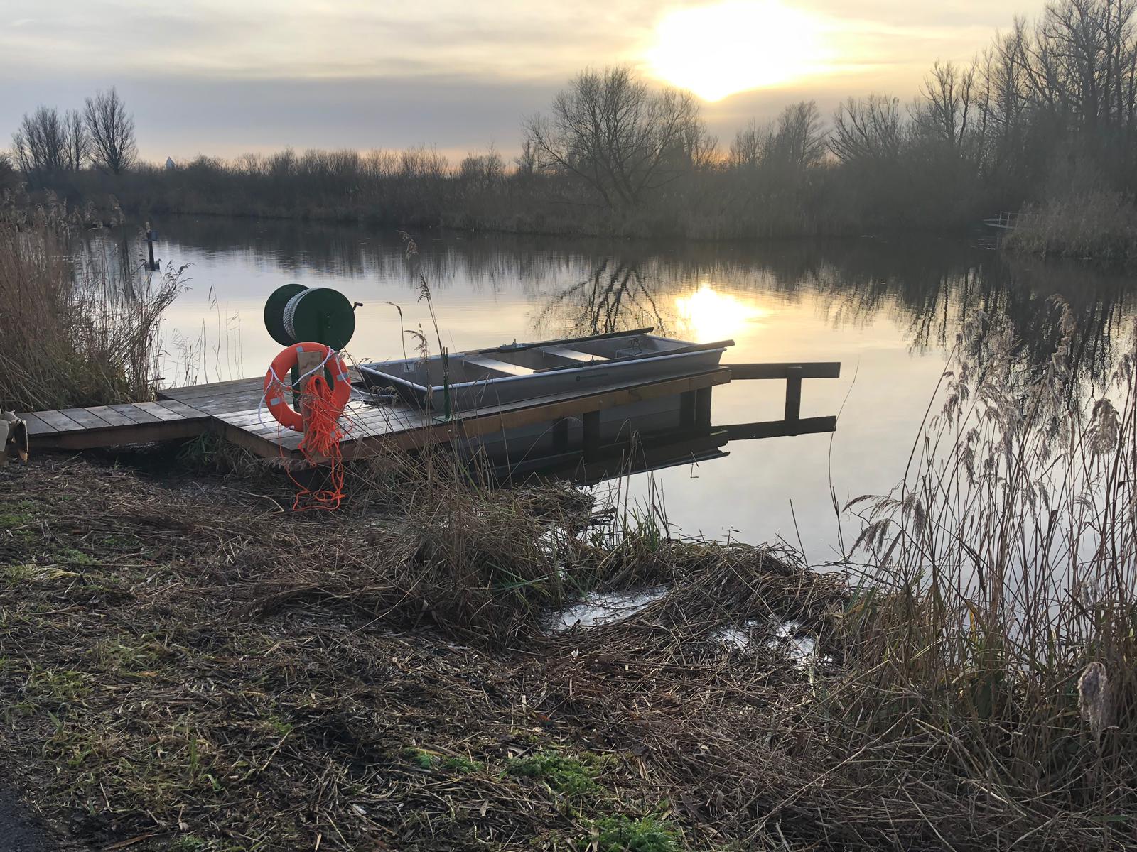
We can monitor the use of route products. We do this with online analyses and RoutAbel app analyses, with the Robinson counter and the dashboard SLIM Buiten!
Smart technologies allow us to measure usage in real time in recreation and tourism, among other areas. For example, the use of facilities can be detected and we can map the use of walking, bridle and cycling paths. By constantly monitoring, we get data at our disposal. With this data, we can optimise the situation. The data can also be applied in product development.
SLIM Buiten! – Internet of things
More and more things are online, such as cars, the thermostat and watches. So everything is connected to each other and to the internet. This is called Internet of things. We turn static objects in outdoor spaces, such as traffic signs, street lanterns and tourist information panels, into smart products. These objects are fitted with sensors. This allows these smart products to provide information (data) about themselves and the space around the object. The sensors transmit the data obtained to our database. The database converts this data into useful information via various applications. With SLIM Buiten!, information about objects in public space is recorded and linked in an up-to-date, reliable and complete way. We physically count walkers, cyclists and horse riders with the Robinson counter.
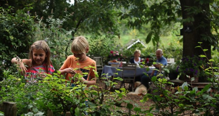
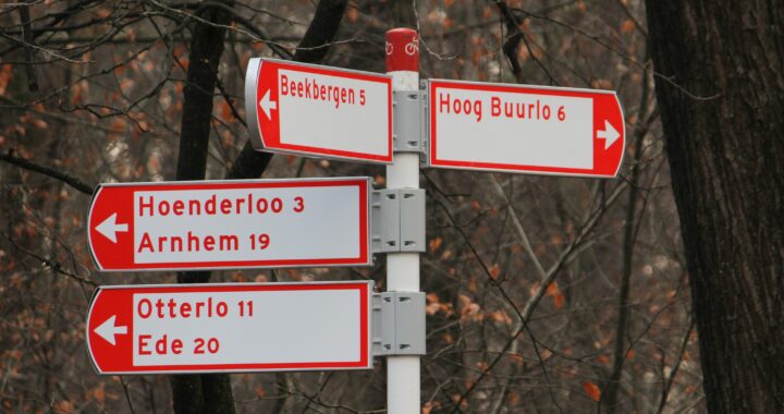
Our view on routes
More and more routes and route networks are emerging in our country. In a village, city, region or province.
For walkers, cyclists, mountain bikers, horse riders and canoeists. Linked to a theme, with or without signposting and equipped with information panels.
Continue reading
Marketing of the route product
We are happy to help think about marketing the product, so that recreational visitors and tourists know how to find and use the products and/or routes.
We can take care of the execution of various marketing products. These include developing and designing brochures, books, counter displays for resellers, as well as setting up and developing packages.
Examples
- Setting up partnerships with booking agencies such as Voordeeluitjes and tour operators such as SNP (app sales in combination with a stay)
- Cooperation with parties selling Christmas packages and business gifts
- Exhibitions; independently and in cooperation with tourist regions
- Internet bannering
- Social media
- Strategic cross-selling
- Joint promotional campaigns with brands such as Nuon, Menzis, Optimel, KRO and FC Twente
Robinson counter
We can monitor the use of route products. With Robinson Counter we make the public space intelligent. Smart technologies allow us to remotely extract all kinds of information from public spaces in real time. Such as:
Continue reading
BioPanel – biobased signposts and information panels
On our way to a sustainable future, we are constantly looking for the most environmentally friendly products. As a replacement for conventional oil-based plastics, we have developed BioPanel. Completely plant-based and biodegradable.Continue reading
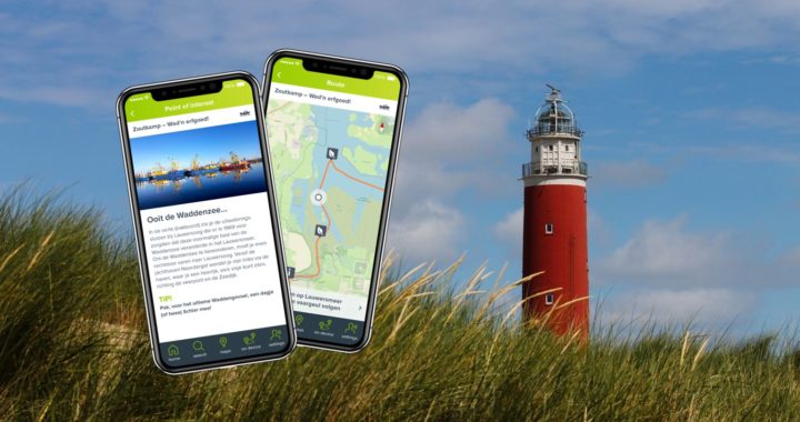
RoutAbel, the Route App
Consumers are doing more and more with their smartphones. We are responding to this with RoutAbel, the Route App with over 600 fun digital cycling, walking and boating routes. Users walk, cycle or sail the most enjoyable routes with their smartphone in hand.Continue reading
HISWA Holiday Sailing
Off the boat – walking – cycling – enjoying! Fun digital walking and cycling routes spread across the Netherlands. These start near a marina or a city centre. More »
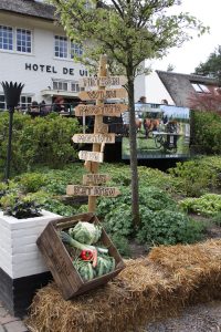
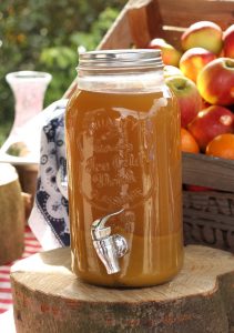
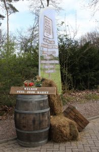
FeelFood
Assignment
Stimulate the target group to go cycling in Overijssel and make them aware of and enjoy pure regional products.
Created
We developed the FeelFood concept: a route-lifestyle concept that connects people, nature and pure food. So that you know what you are eating, where the food comes from and what happens to it before it reaches your plate.
FeelFood consists of:
- 15 separately available digital cycling routes (ranging from 25 – 40km) on the theme of ‘eating naturally’. Including stories from suppliers of regional products, photos, fitness tips, portraits and videos. The digital routes leave at 15 different starting points throughout Overijssel.
- 15 FeelFood recipes which are linked to the 15 digital cycling routes.
- An inspiring book full of information about the region, the routes, nature, recipes and inspiration. With all the recipes, tips and things worth knowing to enjoy for a long time. The book includes a voucher code with which the 15 digital routes can be downloaded for free.
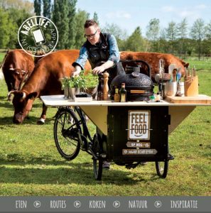
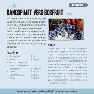
- Collaboration with a local outdoor chef who is available for promotional activities and events.
- A FeelFood cargo bike, equipped with a BlackBasterd barbecue, which can be used at events and fairs.
- FeelFood Market: an annual event at Hotel Landgoed De Uitkijk in Hellendoorn, where you can learn about local products.
Customers
Natura Docet Wonderrijck Twente in collaboration with Provincie Overijssel and Fietscity
Oud-IJmuiden
Assignment
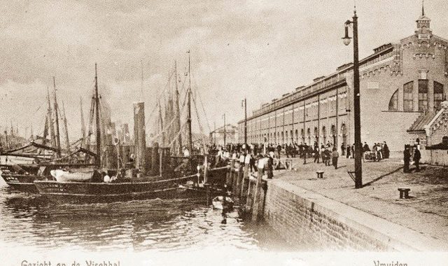
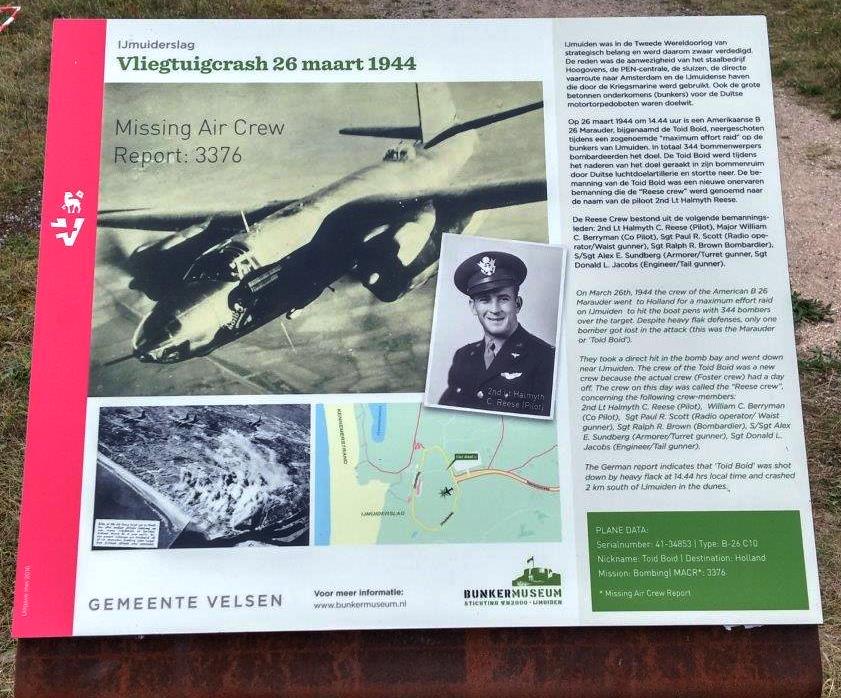
Oud-IJmuiden once was called Nieuw-IJmuiden, a fishing district established after the opening of the North Sea Canal in 1876. Much of Oud-IJmuiden’s history disappeared during World War II and due to demolition in the reconstruction period. Stichting Verhalen Verbinden wants to show the history of Oud-IJmuiden in the landscape. To show something that is actually no longer there.
Created
A 6.5-kilometre walking route with accompanying booklet has been created along vanished or changed and special places. This way, people can search for the soul of Oud-IJmuiden. Oud-IJmuiden wanted to profile itself as Rauw aan Zee: tough because of the port and industry. The design of the 26 panels reflects this. That is why we chose panels made of Corten steel, a material that becomes weathered and acquires a rusty brown colour through weathering. This way, the DNA of IJmuiden is reflected in the final product and thus in the landscape.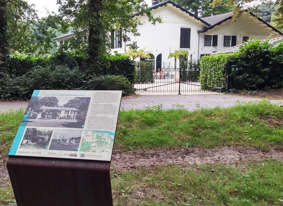
Oud-IJmuiden consists of:
- Digital walking route of 6,5 km in the RoutAbel app
- Brochure with written route and content
- 26 Corten steel lecterns with information panels (design, production and placement) alongside the walking route
- Postcard
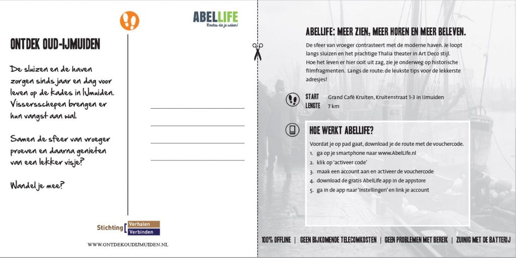
Customer
Municipality of IJmuiden
Foundation Verhalen Verbinden
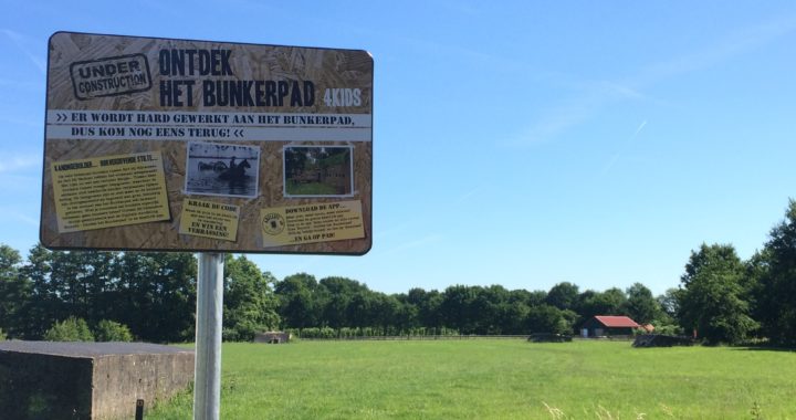
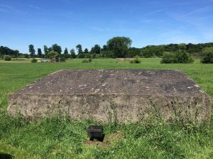
Discover the Bunker trail
Assignment
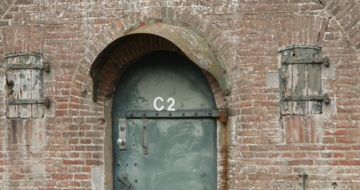
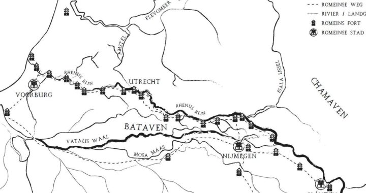
In the area between Fort Vechten and Fort Rijnauwen lies the Bunkerpad. This is a walking route along the bunkers that are part of the Nieuwe Hollandse Waterlinie. Few hikers know the story of the Nieuwe Hollandse Waterlinie, the largest national monument and became part of the UNESCO World Heritage Site in 2021. And even fewer know what role and function the bunkers on this Bunkerpad had. Therefore, the aim is to bring the story of the Nieuwe Hollandse Waterlinie, and in particular the Bunkerpad near Bunnik, to the attention of recreational users and residents of this area in an experiential way.
Created
In June 2017, the Province of Utrecht launched the digital walk Discover the Bunkerpad in Bunnik in the RoutAbel app. This 6-kilometre route is specially designed for children aged 8 to 12 and their (grand)parents, to introduce them to part of the Nieuwe Hollandse Waterlinie while walking. This walk in the app brings the landscape, cultural heritage and stories to life. A ‘Crack the Code’ quiz is part of the route. With this, children can win a fun surprise.
The walking route Discover the Bunker trail consist of:
- A digital walking route for children (8-12 years)
- Information panels pointing walkers to the route
- Promotional flyers, available at restaurants along the route and the Waterlinie Museum at Fort near Vechten
- Realization of 4 metal boxes with numerical codes for the ‘Crack the Code’-quiz
- Promotion on various websites
- Follow-up: develop an inspirational spot on the Bunker trail in collaboration with entrepreneurs along the route
“this walk in the app playfully introduces children to cultural heritage. And as a parent, it is great to join the exploration.”
Mariette Pennarts, deputy of the Province of Utrecht
Customer
Province of Utrecht
Waterworks route
Assignment
Inform visitors to the area of the Nieuwe Hollandse Waterlinie in an experiential way about this historic defence system. This is the largest national monument and nominated to become a UNESCO World Heritage Site in 2019.
Created
The Waterworks Cycle Route is already physically marked in the field, by using the existing cycle junction signs. We have developed the digital cycle route Waterworks Route in the RoutAbel app. It runs straight through the line landscape and past water and military structures, telling the stories and history of the line landscape. The cycle route also connects and enhances the military sites and provides visits to entrepreneurs along the way. Entrepreneurs are involved in arrangements and the promotion was done together with them.
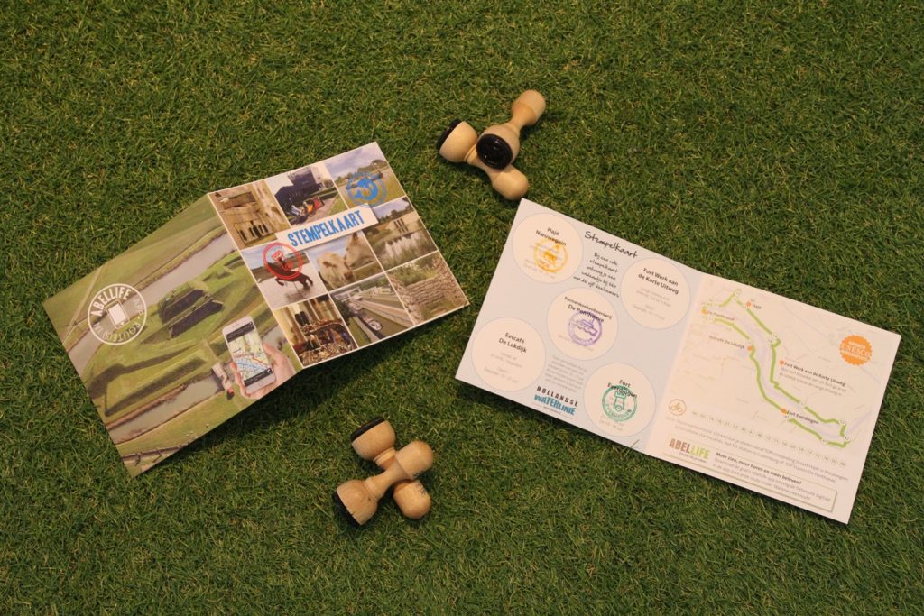
De Waterwerkenroute consists of:
- A cycle route of about 30 kilometres through the line landscape with 3 starting points in Culemborg, Nieuwegein and Vianen
- A postcard intended to promote the route, which is available at every business along the route
- A stamp card. The purpose of this stamp card is to further encourage people to cycle the route and visit the various businesses along the route. At each participating business, cyclists will receive a stamp. On returning a full stamp card, they will receive a gift.
Customer
Province of Utrecht
Liberation Routes
Assignment
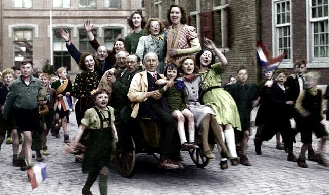
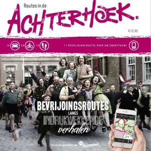
2015 marked the 70th anniversary of the liberation of the Achterhoek. World War II also left indelible traces here. The aim of this project is to keep memories alive and educate about events during the Second World War, especially among young people.
Created
We were asked to put the Liberation of the Achterhoek in the spotlight and turn it into a recreational tourist product. This is an extension in the Achterhoek to the existing Liberation Route concept with routes in regions such as Arnhem-Nijmegen and the Veluwe. In 11 impressive routes, you get to know the people and their stories. With leading roles for the victims and heroes of the past. So that we do not forget… and so that we continue to learn from the past.
Liberation Routes consists of:
-
- 11 digital routes in the RoutAbel app
- A promotional booklet about these routes
- Translations of these routes and the booklet in English, German and Dutch
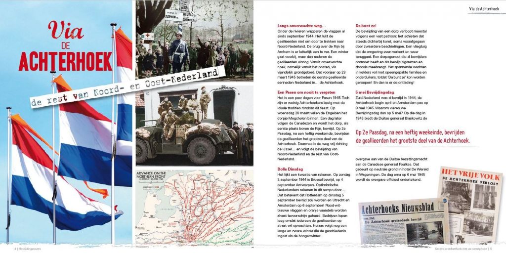
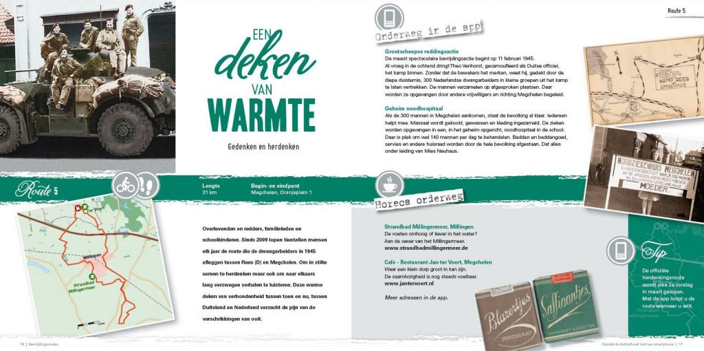
Customer
Foundation Achterhoek Toerisme
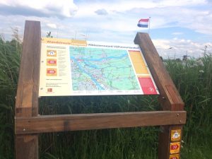
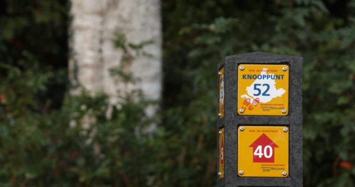
Walking network Alblasserwaard-Vijfheerenlanden
Assignment
The Alblasserwaard-Vijfheerenlanden area is home to four top locations, such as the windmills of Kinderdijk (on the UNESCO World Heritage List since 1997) and Leerdam as a Glass City. Most tourists and recreationists visit one top location and then leave this region. The aim is of this project is to attract visitors from (one of) these places into the area, make them stay longer in this region and spend more.
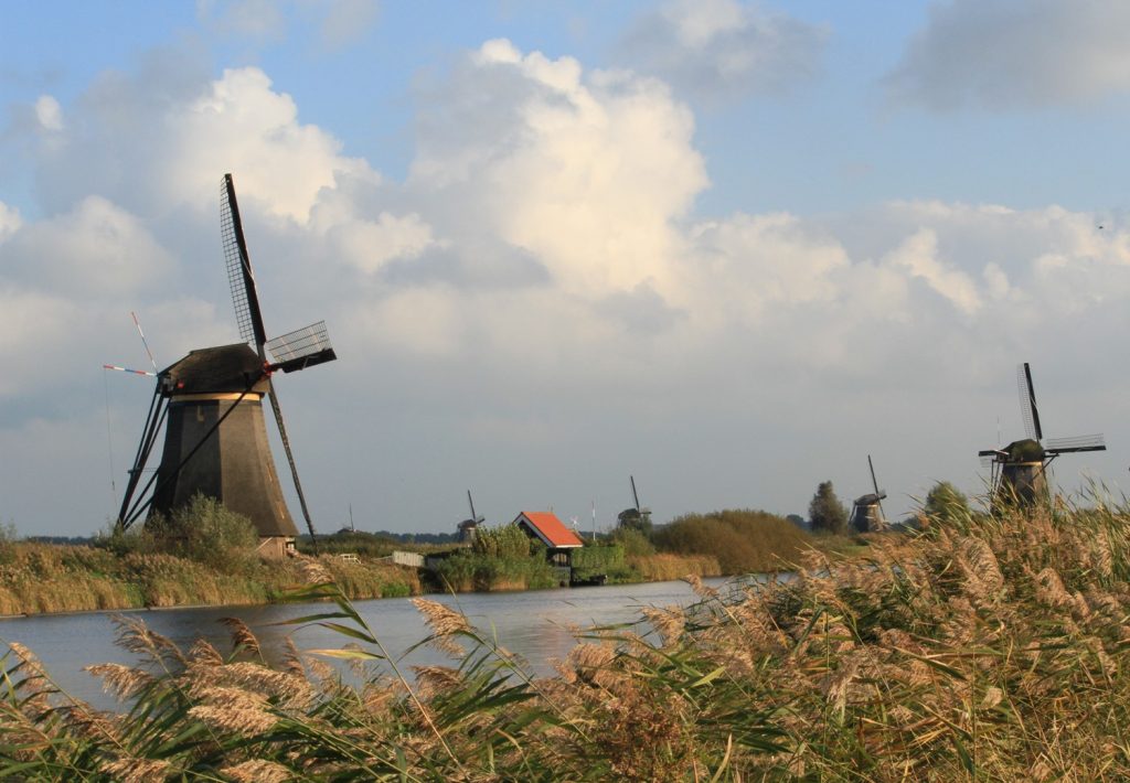
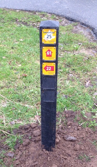
Created
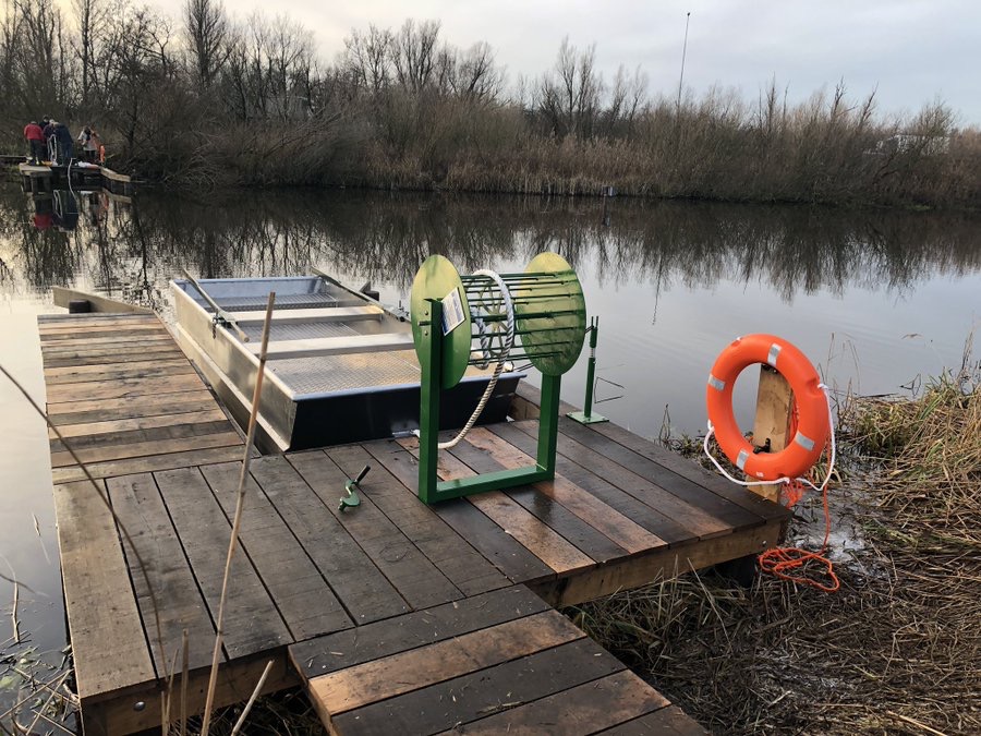
To make the area more attractive, a junction network of almost 600 km of walking routes has been created. We installed junction posts, route signs and around 60 information panels along the route. On the information panels, we provide suggestions of beautiful walking routes via the junctions. Via a digital route planner or the walking map, you can also plan your own route.
We count visitor movements in the walking network by means of sensors to show the number of visitors. This provides insight into how many people move into the area and whether it is interesting to further expand the infrastructure.
Walking network Alblasserwaard-Vijfheerenlanden consists of:
- Approximately 600 km of walking network (paved and unpaved)
- Production and placement of over 60 information panels, junction signs and route signs
- Production and construction of decks, bridges, crossovers, etc.
- Production and construction of a rowing boat that acts as a ferry
- 11 thematic digital routes in the RoutAbel app
- Monitoring the number of users through sensors
 “I regularly hike and organise walks with a group myself. I often then create my own combination of walking routes. If you are not familiar with the area, the walking route network is very useful for orientation. You can think of your ideal route from home. And if it works out that way, you can adjust the route again on the spot using the map and the junctions.“
Rien van den Berg, Association TeVoet
Customer
Regiobureau Alblasserwaard-Vijfheerenlanden
Walking at Rhijnhof
Assignment
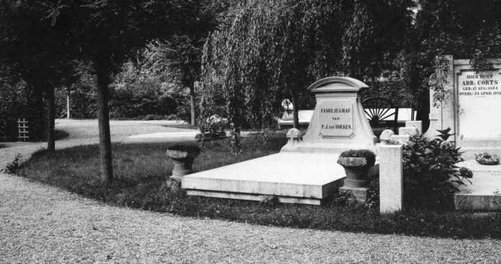
Encouraging people to take a walk around Rhijnhof cemetery in Leiden and showing them the historical value of the place in a respectful way.
Developed
A walking booklet describing a one-hour walk past monumental ancient trees with special stories about nature, the cemetery, various works of art and the place. The walking route gives an impression of the cemetery as a former estate, beautiful in nature with moments of contemplation.
Just outside the cemetery, two information panels have been placed with the aim of inviting walkers to visit the cemetery.
Walking at Rhijnhof consists of:
- A walking booklet (available at the cemetery teahouse)
- Two information panels with appealing content
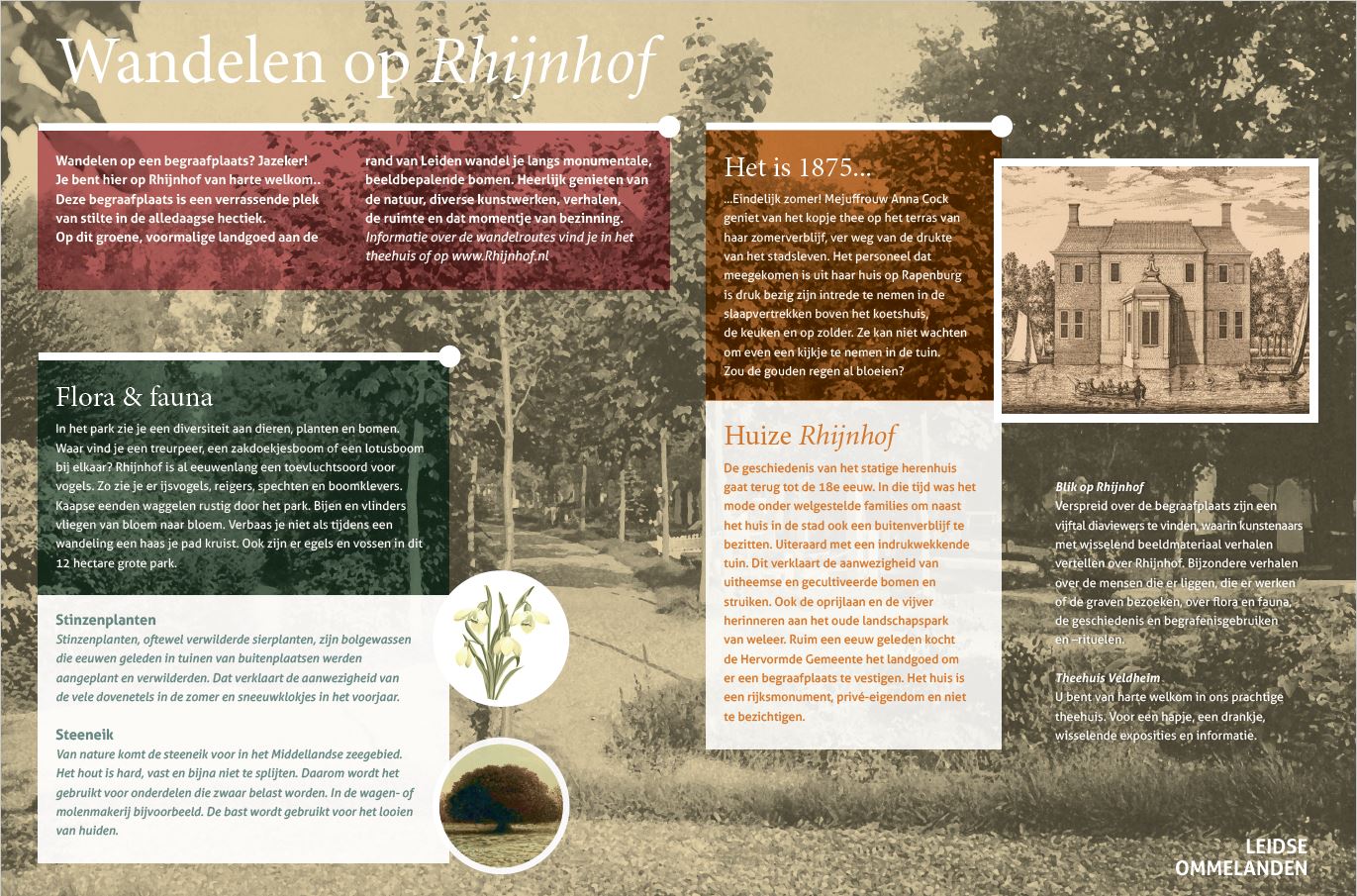
Customer
Cemetery Rhijnhof
Realisation of route products
We not only come up with concepts, but we also execute them; from idea to concrete final product. This can involve the entire project from A to Z.
Or we carry out a part, for example the production of physical elements or a digital RoutAbel route. Whatever the customer wishes. We also work on already existing plans, such as the construction of a walking or cycling network.
Examples
- Wandelnetwerk Rijn- en Veenstreek & Zoeterwoude: We assisted in the entire project.
- Bunkerpad, Bunnik: We realised a digital RoutAbel route, produced and installed information panels, prints and physical experience elements, and took care of the promotion.
- Fietsknooppuntennetwerk Veluwe: Hierbij hebben wij frames, informatiepanelen en prints geproduceerd en geleverd en bevestigingsmaterialen en dragers geleverd.
- Theme routes such as FeelFood
Concept- & product development
It starts with the basics, with the question of the customer’s demand. We try to get the most important goal clear: what does the customer really want?
We then develop a suitable concept. In this process, the end use comes first. Whether we are constructing a walking network, developing a thematic, digital RoutAbel route or supervising the marketing of a tourist region. We do everything we can to connect to the motives of this end user in order to give him an optimal experience.
CO2 Policy
Climate change is an enormous collective challenge for the upcoming decades. The environment, people and animals will be affected by the changes.
Continue reading
Mees Drabbe
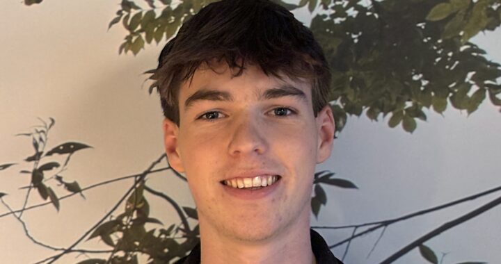
The youngest of our team. Mees too is active for AbelLeisure during holidays. At the office, where he assembles signs and brackets, or somewhere in the fresh air to survey a walking network. His greatest passion is football. At Sportclub Lochem, he plays in the JO16-1 , trains pupils and whistles their matches. And then he also manages to make time for gaming with his friends!
Milestone Alphen aan den Rijn
Assignment
In the municipality of Alphen aan de Rijn, numerous archaeological sites from the Roman Limes period have been excavated and are still present. However, much of the Roman history is still buried and unseeable. The aim of this project is to tell something about the history in this landscape. So that recreants, tourists and travellers are informed about the historical value of the place.
Created
The concept consists of milestones, a reference to the Roman Period, on which the story of Roman history and excavations is told. Panels are attached to the milestones, and on these panels you can read more about the location of the milestone and the role it played in the Roman Period. These milestones fit right in with the Limes atmosphere.
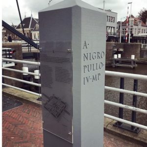
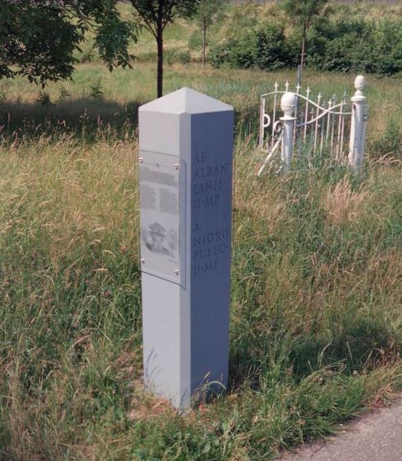
Milestones Alphen aan de Rijn consists of:
- 4 milestones in the municipality of Alphen aan de Rijn (writing texts, finding suitable images)
- Design and production of the information panels
Customer
Municipalities Alphen aan de Rijn, Nieuwkoop and Zoeterwoude